London Heathrow Airport (LHR)
City Orientation and Maps
(London, England)
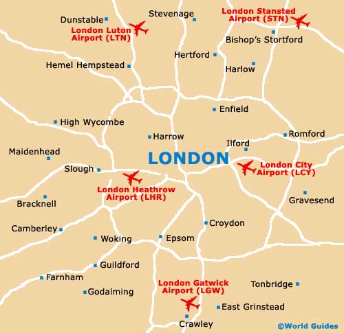
The city of London has long been the capital of England and has much to offer in the way of tourism and historic sights. Lying on the south-eastern side of England, London is near to a number of prominent towns and cities, such as Crawley to the south, Harrow and Basildon to the west, Basingstoke to the south-west, and High Wycombe to the north. Also worth noting, Hounslow is located on the western side of the city and is particularly close to London Heathrow Airport (LHR).
The M25 motorway surrounds the whole city and makes driving to many suburban areas both quick and easy, although during peak hours, many stretches of the M25 can quickly become congested. Heathrow Airport is close to the M25 and M4 intersection and is also connected to London's vast network of underground trains.
London Heathrow International Airport (LHR) Maps: Important City Districts
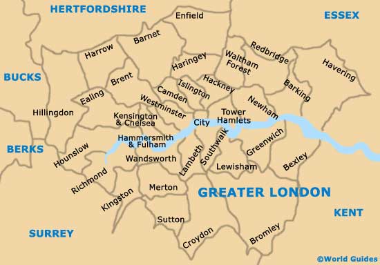
The whole of London is split into six main zones, which relate to the London underground trains, being clearly displayed on most maps. Zone 1 incorporates the city centre itself and includes many well-known locations, such as St. Paul's,. Regent's Park, Marble Arch, Covent Garden, Charing Cross and Piccadilly Circus, amongst others.
Zone 6 is the furthest of the zones and includes underground stations to London Heathrow Airport (LHR), to the west. There are two main stations at the airport, Terminals 1, 2, and 3, and also Terminal 4. Other stops nearby include Hatton Cross, Hounslow West, Hounslow Central, Hounslow East, Osterley and Boston Manor. Heathrow Airport lies at the end of London underground's Piccadilly line.
England Map

Greater London Map
London Map